Thanks to a generous donation to our non-profit in December 2022, we have been able to provide valuable transportation analytics by learning and using our analytics software.
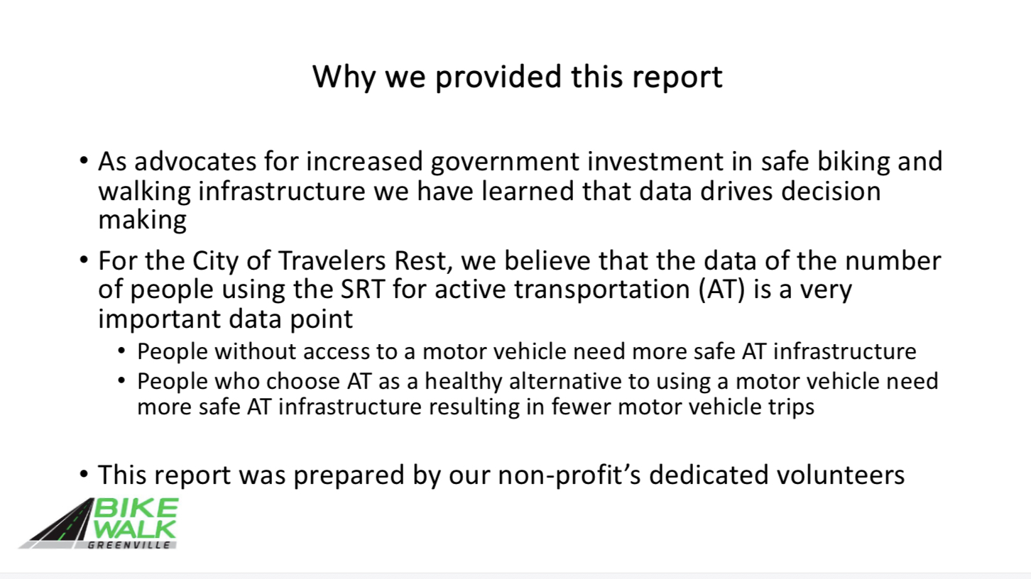
In using this software we are able to advocate for more safe walking and biking infrastructure with compelling facts about how our existing infrastructure is used.
As a courtesy to the City of Travelers Rest we have shared this information with City Council and staff, and commented that such a report would otherwise be available only from a private consultant at significant cost.
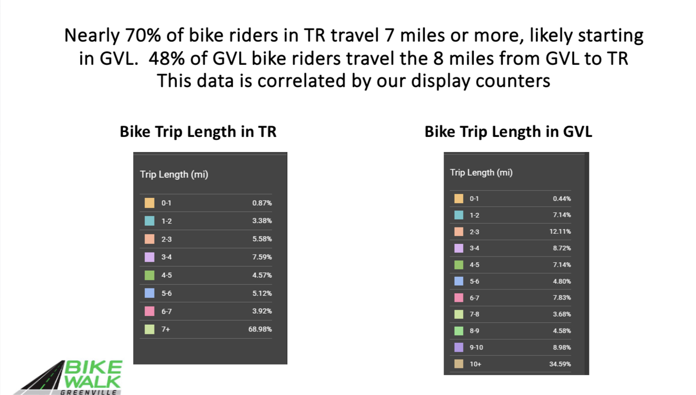

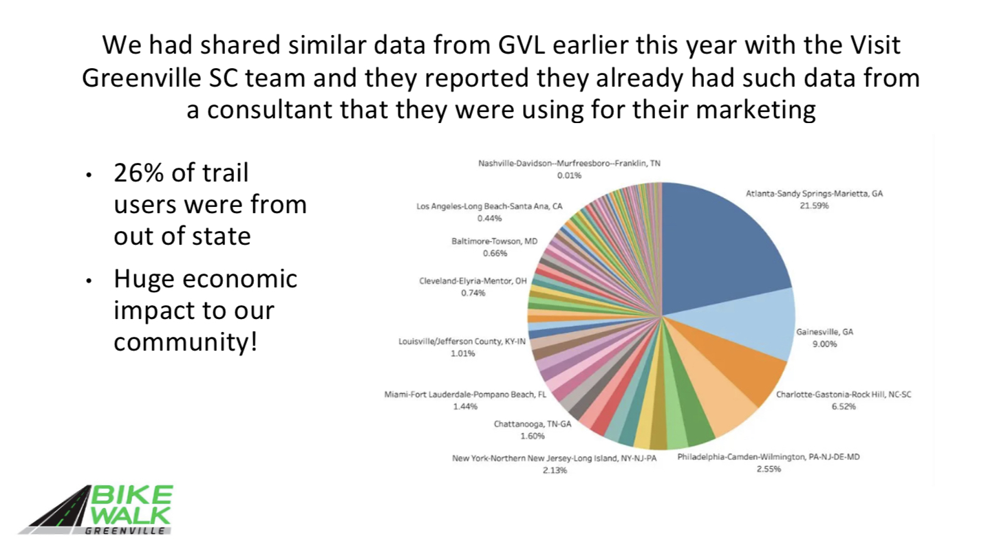
89 Metro Areas in 26 states are the homes to 30.7% of SRT TR Bike Riders who do not live in the Greenville-Mauldin-Easley Metro Area
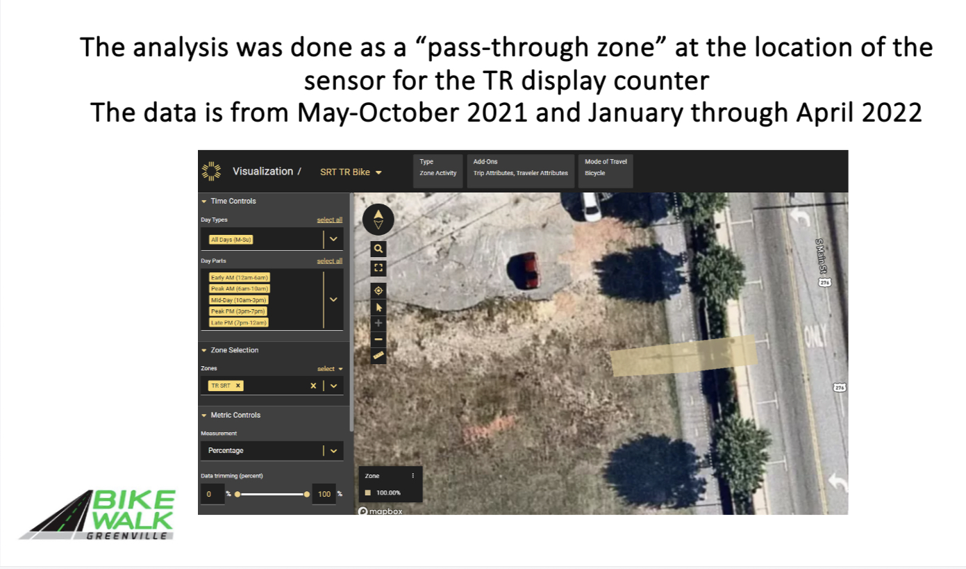
Transportation Analytics Software, sometimes referred to as “big data analytics,” uses data derived from location-based services from cell phones, and gps devices.
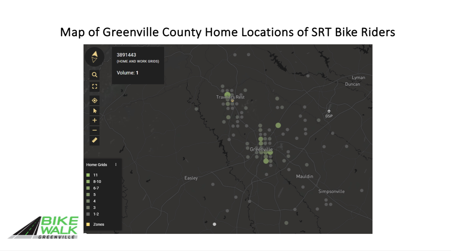
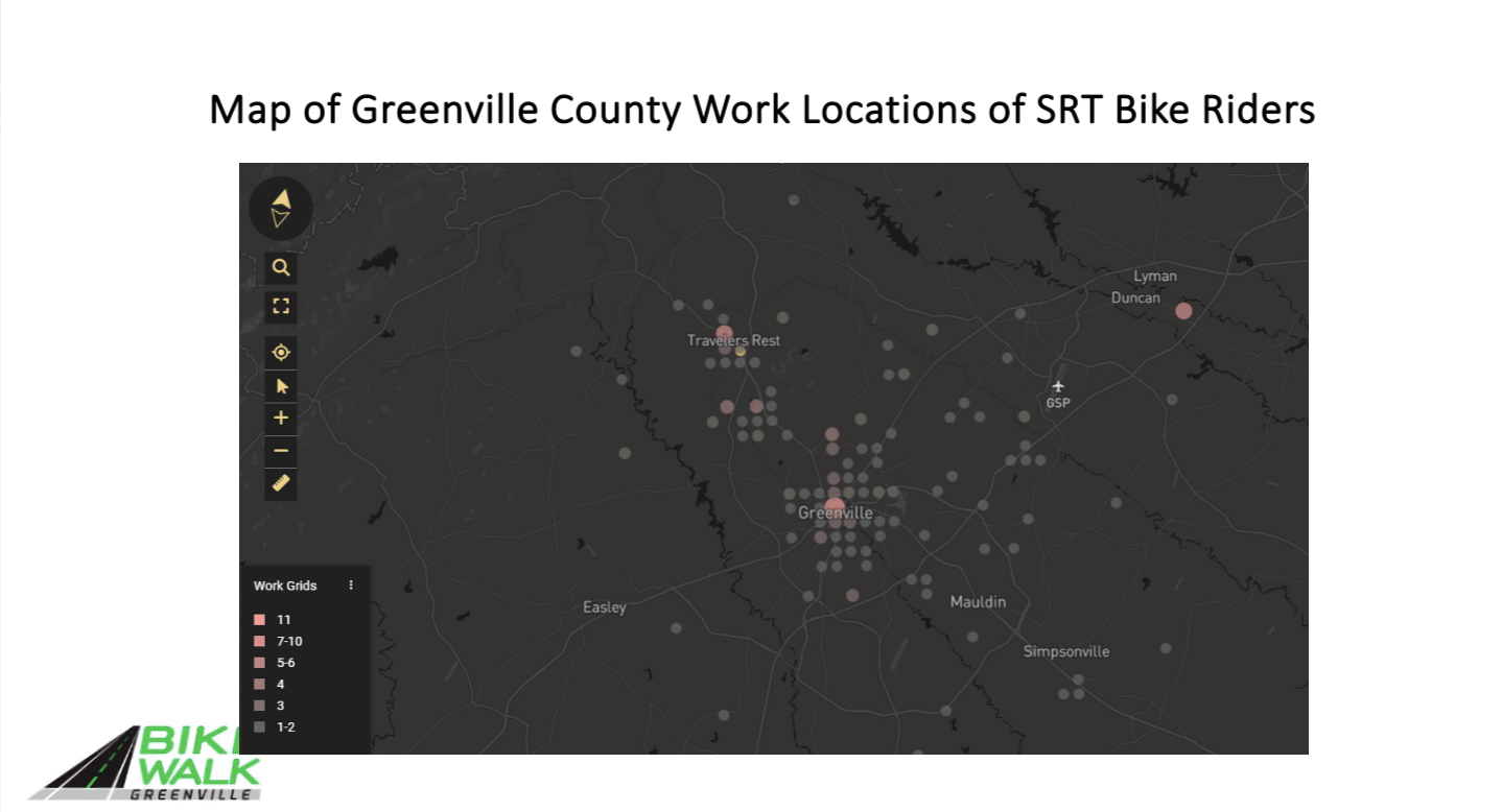
Billions of points of data, that are anonymized provide the interesting information in our report. The software knows where the cell phone user sleeps each night, and visitors to Travelers Rest are identified as such because the software knows the cell phone owner’s neighborhood.
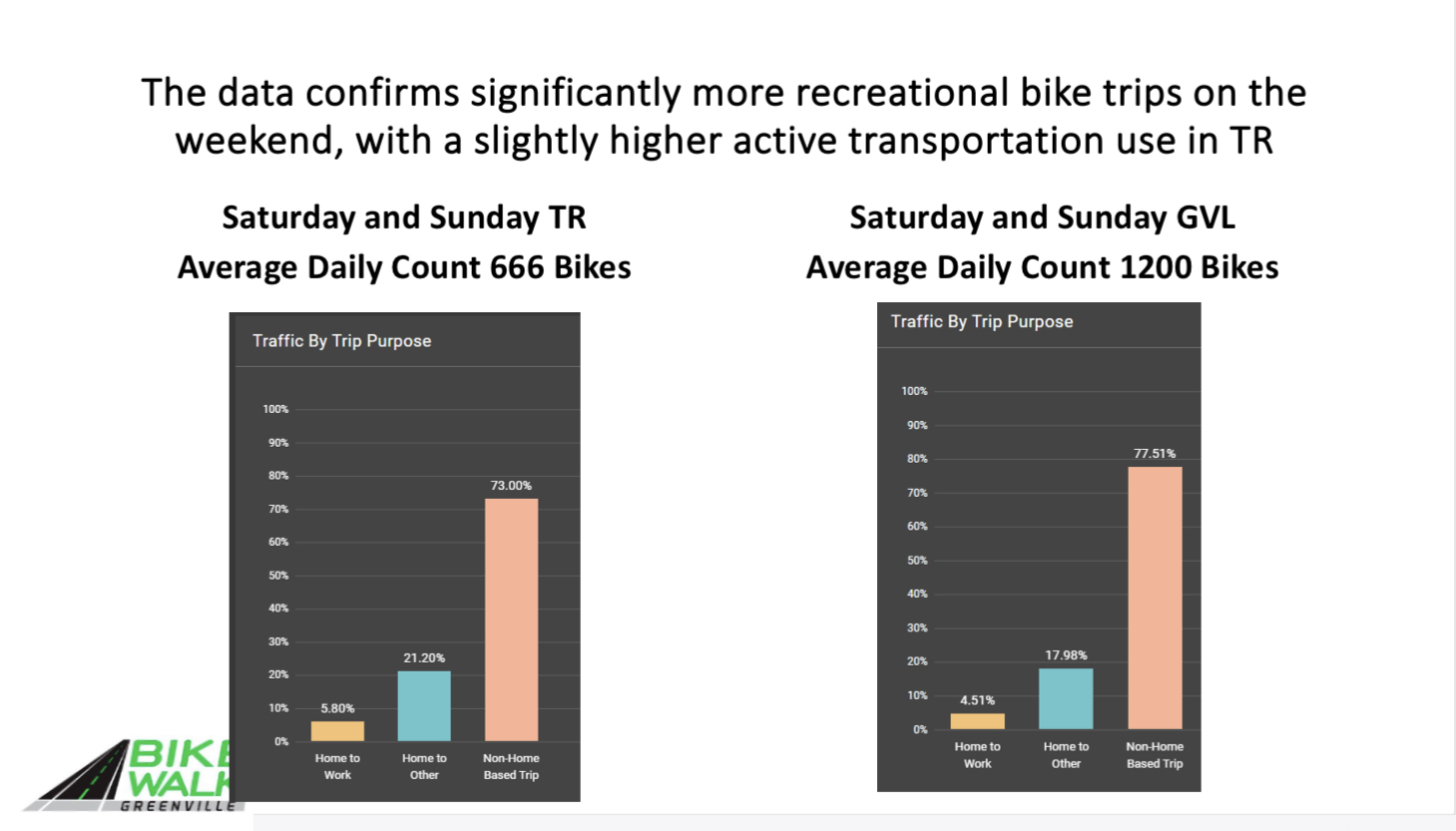
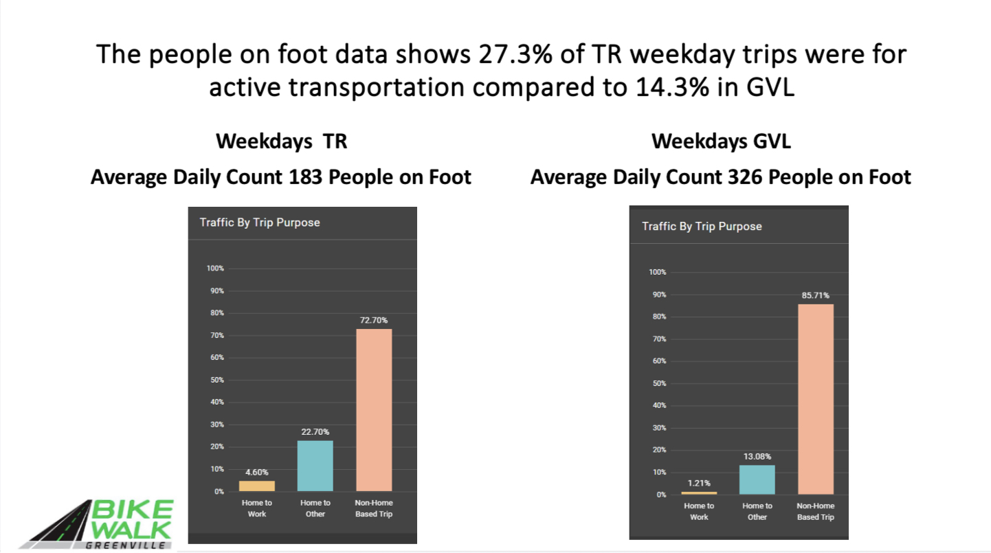
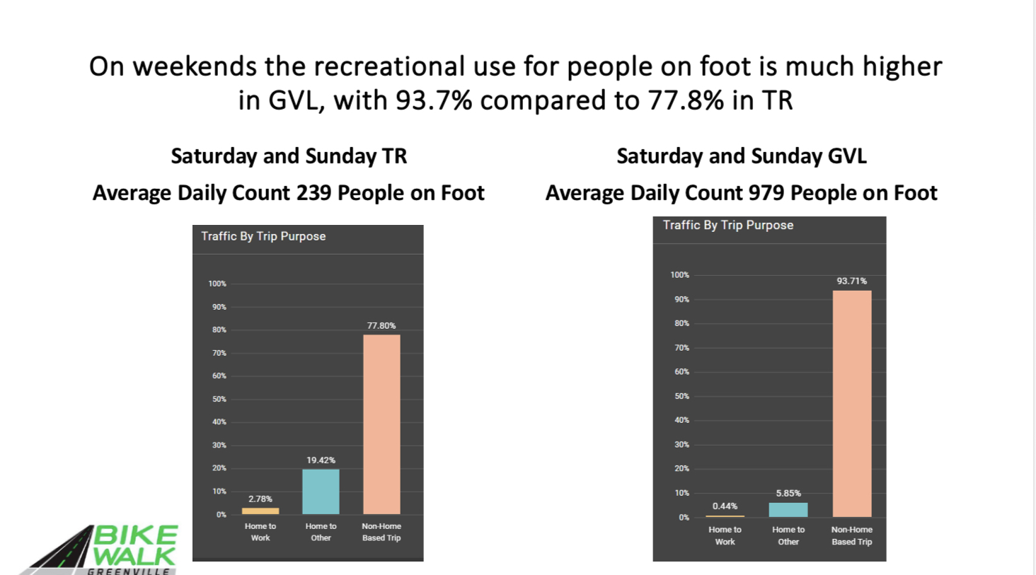
A non-home-based trip begins at a location other than home (or work). An example would be someone who lives in Greer and drives to Unity Park in order to ride his bike to TR for lunch with friends.
A home to work trip is just that, a person commuting by foot or by bike.
A home to other trip is going to a meeting or going shopping or to a restaurant by foot or by bike.
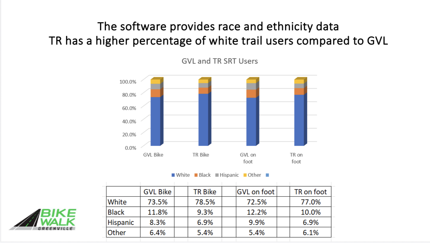
It knows the census block tract (neighborhood or general area) not the exact location.
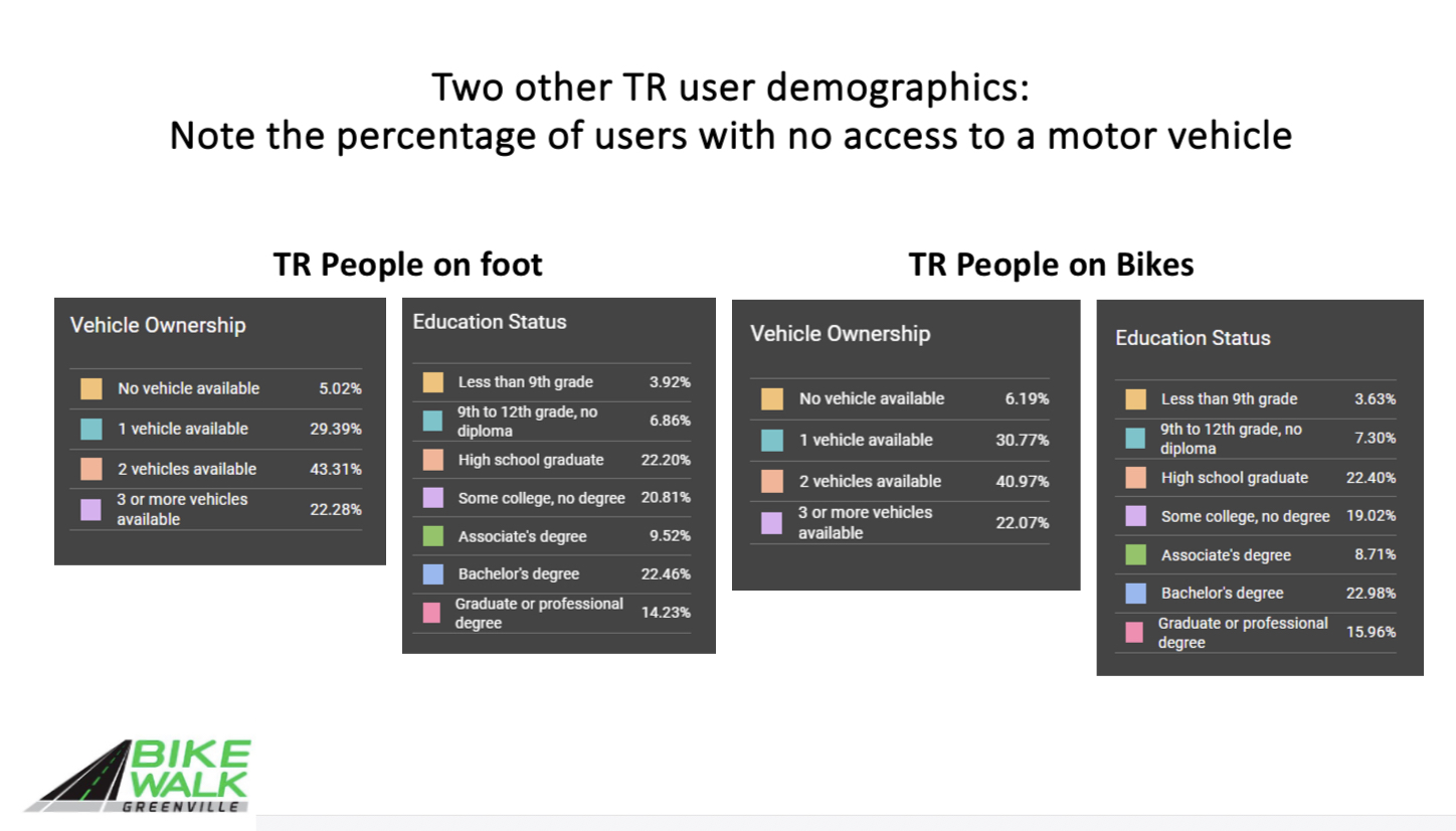
Thus demographics, such as education, or ethnicity, the software uses the socioeconomic data at the census block level. When we report that 5% do not have access to a motor vehicle, that information is also available for each census block in the US.