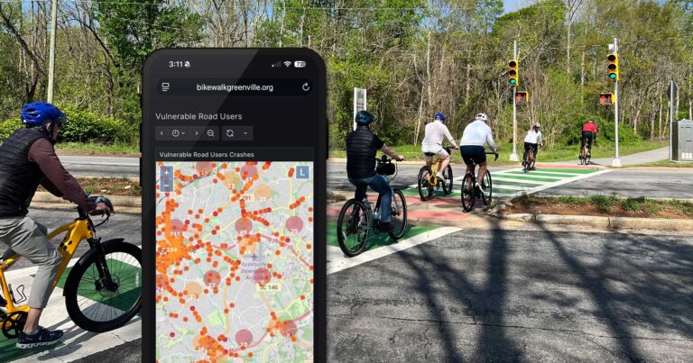
Bike Walk Greenville has recently used our StreetLight Data (SLD) license to learn more about pedestrian and bicycle use in the vicinity of the White Horse Road Walmart Supercenter. In 2021 Bike Walk Greenville advocates started looking at White Horse Road after reading Right of Way by Angie Schmitt and the Smart Growth America’s Dangerous by Design Report. This study compliments the work done in December 2021 by our Furman Intern Loise Aleria, Dangerous by Design in Greenville County.
SLD is a “big data” product that can track billions of data points each month including anonymous cell phone data from people on foot, on bikes, and in their motor vehicles. A large donation to our non-profit for the SLD license makes this effort possible
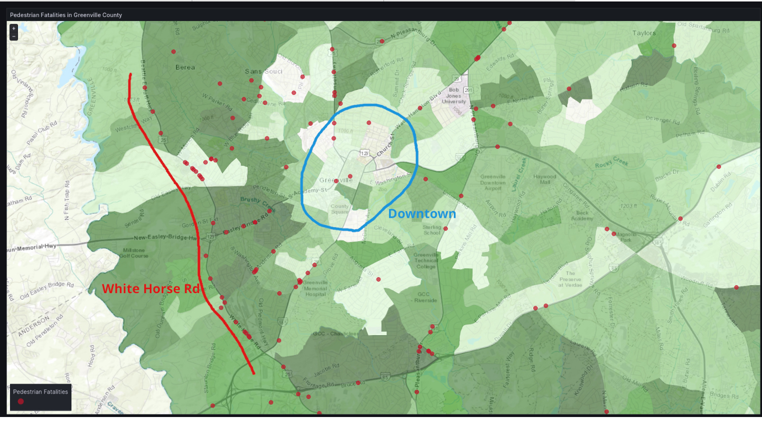
Bennett Meares created this panel that shows the pedestrian death locations as well as the ADI (Area Deprivation Index) for our community. The darker the shade of green, the higher is the index. The pedestrian deaths are from 2009 to 2021. At the below link you can study the map in more detail
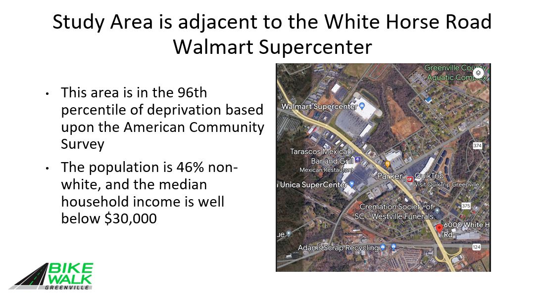
20 year South Carolina Department of Public Safety (SCDPS) data visually shows the patterns of collisions involving pedestrians (red dots) and cyclists (blue) along Greenville’s Dangerous By Design arterial roads. The inset shows the particularly high concentration of collisions along White Horse Road (25) near West Blue Ridge (253), which is ranked one of the most dangerous intersections for pedestrians and cyclists in the nation.

On February 10, 2023, Bike Walk Greenville advocates met with SCDOT District 3 Traffic Engineers to discuss our findings.
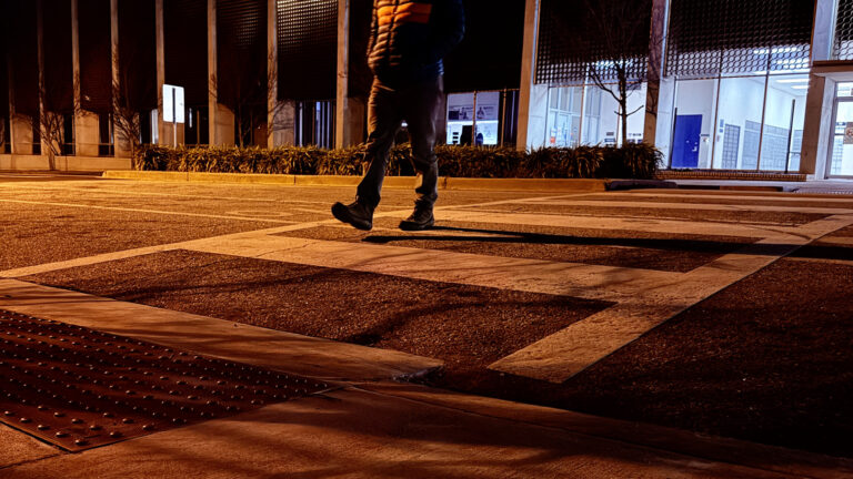
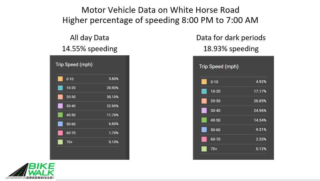
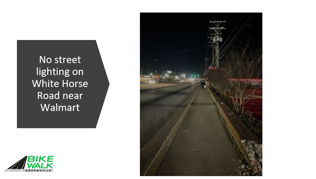
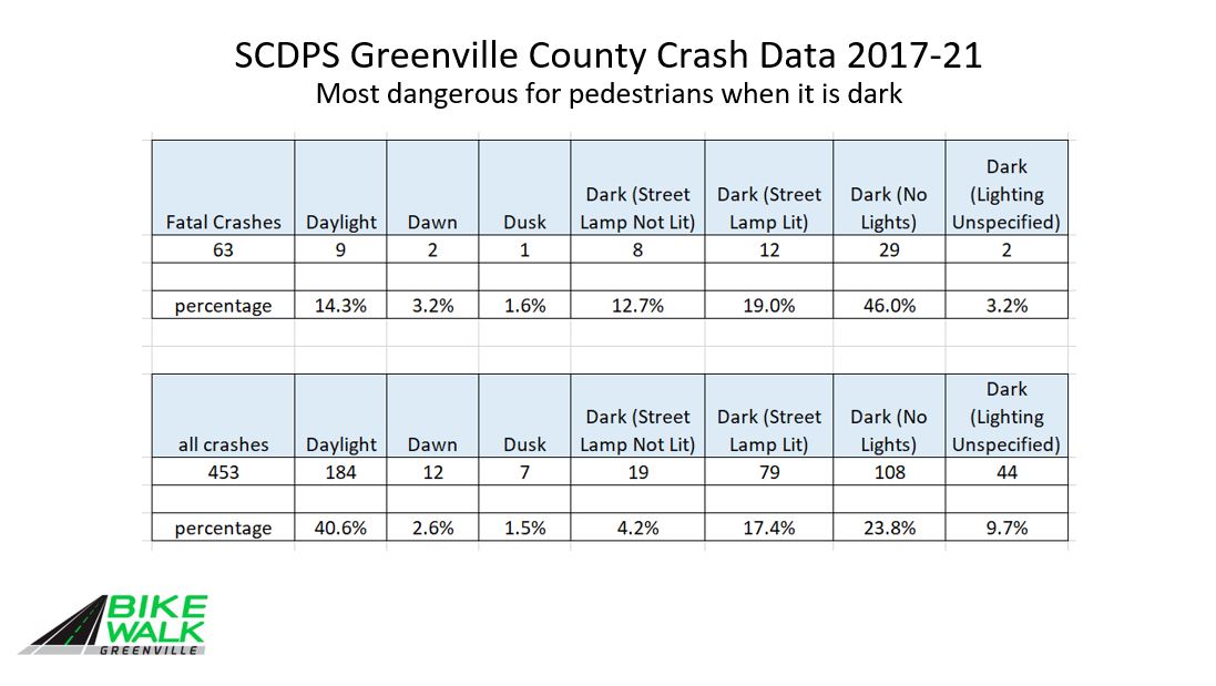
•We pointed out that Community activists have long asked for lighting on White Horse Road
•We suggested slowing motor vehicles by modifications to road design needs to be seriously considered by SCDOT
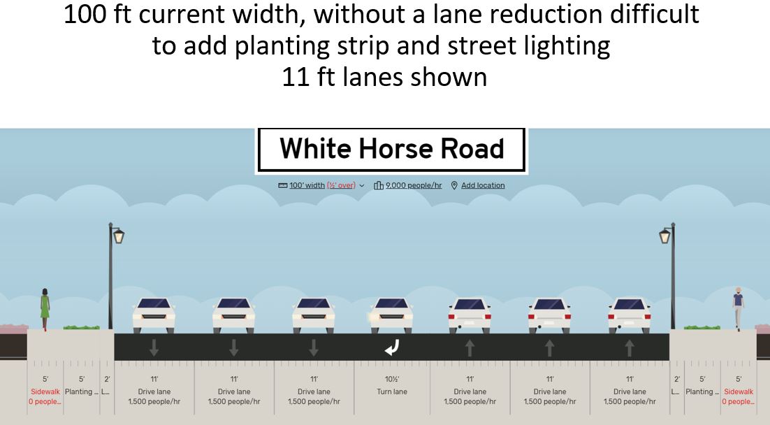
•At a minimum, lane widths should be reduced to 11 ft as shown on next slide
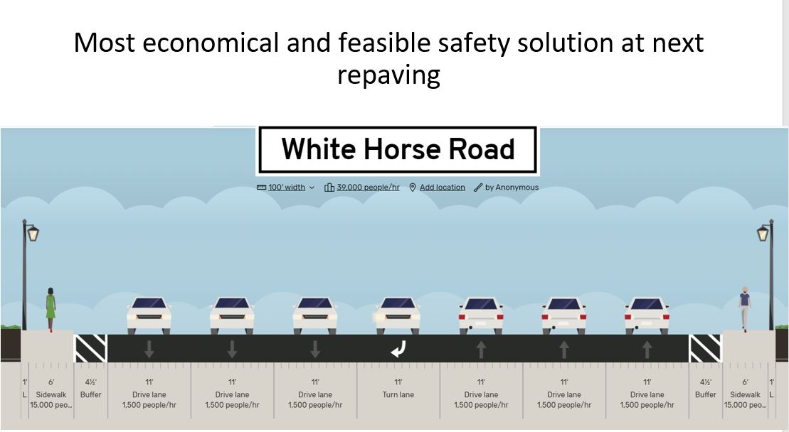
•At the February 10th meeting SCDOT District 3 Traffic Engineers agreed that narrowing the travel lanes at the next repaving would help to reduce motor vehicles speeds
•They explained that policy is not to change the curb and gutter line as suggested on the previous slide, as this is very expensive
•Curb lawns are only provided when paid for by local government who would be responsible for mowing
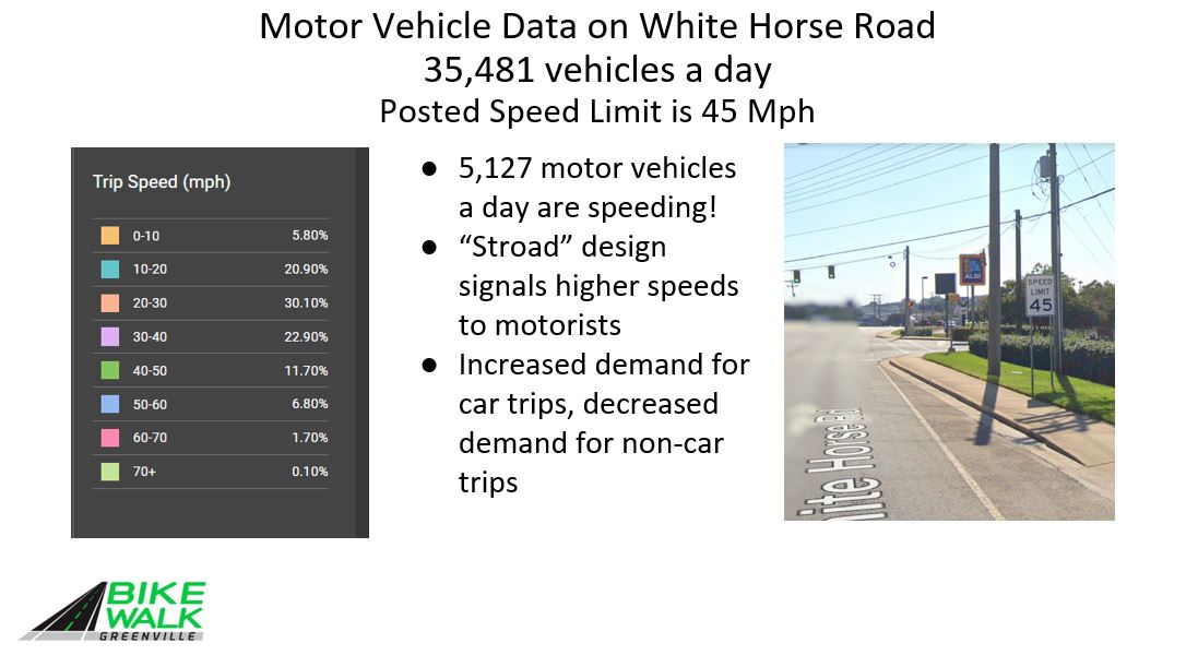
•A road diet from 6 travel lanes to 4 is not possible due to the traffic volume of 35,481 vehicles a day is above the 30,000 maximum for 4 lanes
•As such the next slide shows, narrowing the lanes provides a buffer between the sidewalk and the motor vehicles
Greenlink Transit Ridership
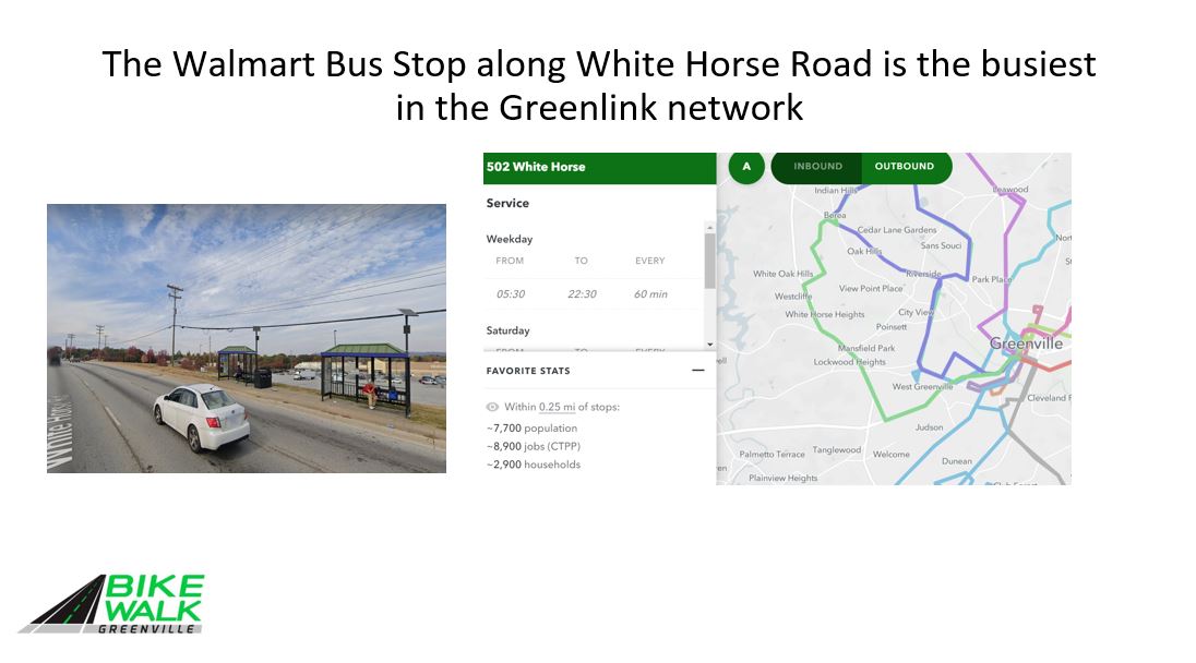
•25 a day get on and 26 get off at Walmart
•5 a day get on, and 4 a day get off across the street
•This means few bus riders are crossing White Horse Road
•Long term Greenlink plans to add more buses to allow more frequent service than the current hourly frequency
•This will provide increased mobility options for those without a motor vehicle
Downtown restaurants cannot get enough staff due to high cost of car ownership
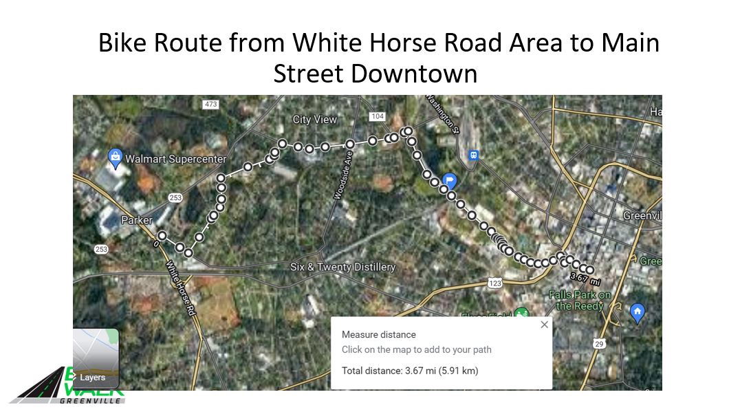
•The use of residential streets, like the Augusta Road Bicycle Boulevard Bypass is an easy answer for connection to the Prisma Health Swamp Rabbit Trail network and downtown Greenville
•Way finding signs will advise locals of a way to get downtown by bike
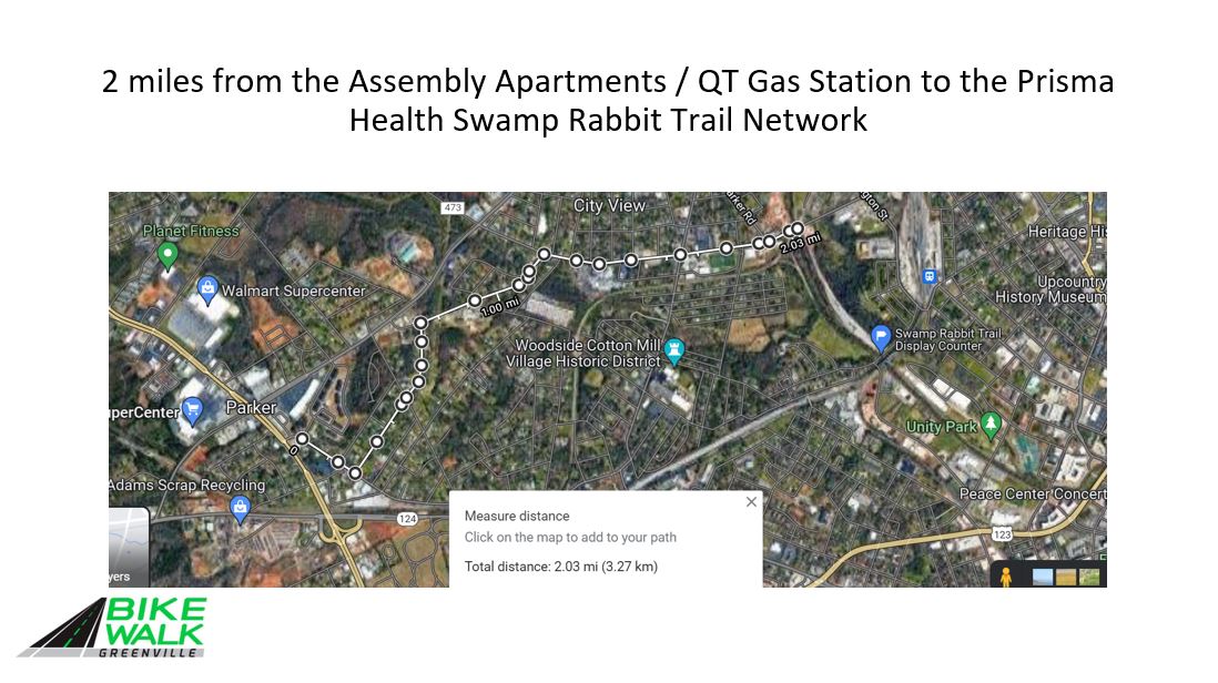
•2 miles of relatively lightly traveled streets
•Another 1.5 miles on the SRT
•3.67 miles to Main Street in downtown Greenville
Path Forward on Bike Route to Downtown
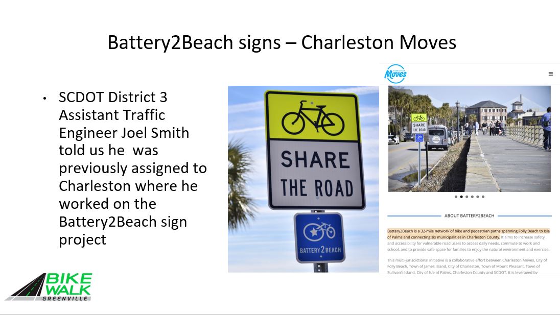
•At the February 10 meeting SCDOT agreed that a sign project is viable and provided an example from Charleston
•Bike Walk Greenville will work with County staff to develop signs for this route for both directions and help with getting encroachment permits
•SCDOT will allow sharrow markings on pavement for low traffic way finding purposes
•A BWG committee will be established to obtain community engagement on the route
•When cost estimates are available, a fundraising campaign will be launched
Conclusions
•The data from crash histories and StreetLight Data clearly shows the need for street lighting along this section of White Horse Road
•Narrowing the travel lane width to 11 ft. will help to reduce speeding, and should be implemented at the next repaving projects
•A safe route to reach downtown by bike will provide transportation options for those without access to motor vehicles